Off to the Rockies: Austin to Denver

For Memorial Day Weekend, Victoria and I decided to visit her dad in Denver. Her dad had just recently moved there and it was a state that both of us had never been to. I was definitely up for a road trip there.

We hit the road and it was hot and dry.

Car dashboard display showing 6,281 total miles, Trip 1 statistics of 79.4 miles at 38.5 MPG with 423 miles remaining range, exterior temperature 91°F Straight rural highway stretching into the distance under cloudy skies, with power lines running parallel to the road and flat grassland on both sides

We decided to stop at the Schlotzsky's Deli in Lampasas.

Exterior view of Schlotzsky's restaurant building featuring distinctive red curved awning with every bite lotz better slogan and Cinnabon co-branding signage

Their local team was the Badgers also. I see they kind of "borrowed" Bucky from Wisconsin. I was told the 2 different numbers on Bucky were actually the 2 numbers of the owner's kids in the sports they played.

Badger Country promotional poster featuring Wisconsin Badgers mascot Bucky Badger in number 6 jersey displayed inside restaurant

Schlotzsky's was a good choice, because the service and food was great. I ended up thinking a large was smaller than it was, so I definitely needed to get a to go bag. Also, the hot sauce was very good.

Schlotzsky's sandwich on sesame seed bun cut in half with toothpicks, showing layered meat and cheese filling, served with pickle spear on branded wrapper Bottle of Schlotzsky's branded hot sauce with orange-red contents and decorative flower logo, sitting on restaurant table

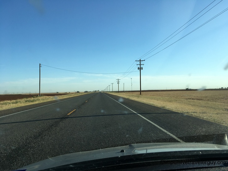
Before you knew it, we were on the road with the sun slowly setting.

Sunset view through car windshield on rural highway with power lines silhouetted against orange and blue twilight sky Golden hour view from car on rural highway as sun breaks through clouds creating dramatic lighting on flat landscape

We made it to Brownwood. They have some of the weirdest stop and go light posts where you have to strain your neck to see if you're at the stop line.

Multi-lane urban road at dusk with traffic backed up under overhead signal gantries, sunset visible in background

They do have a cool sign for Underwood's Cafeteria. I always think it's kind of cool when I pass through. Sometime, I think I'll have to stop.

Vintage Cafeteria neon sign at sunset with additional business signage and traffic lights along commercial street

After Brownwood, the sun continued its slow descent.

Highway view at sunset with trees silhouetted against pink and orange sky, road disappearing into dusk Night driving view with car headlights illuminating rural highway's yellow center line, fading sunset colors visible on horizon Night driving scene with motion blur showing power transmission tower and headlights cutting through darkness on rural highway

After the sun set, it was crazy with the amount of bugs. We were in the middle of nowhere, so the headlights were the only source of light. I swear, it sounded like it was raining from the amount of bugs we hit along the way.

By the time we got to the hotel in Lubbock, it had cooled down substantially.

Car dashboard at night displaying 8,519 total miles, Trip 1 showing 317.8 miles at 38.6 MPG with 400 miles range, temperature 75°F

We got some sleep and then had breakfast the following morning. It was supposed to be hot in Lubbock that day. Right before we left, it was already 72.

Car dashboard showing 6,640 total miles, Trip 1 at 120.8 miles with 37.5 MPG and 380 miles remaining range, temperature 72°F

We went to 7-11 and got some caffeine for the journey. I realized the La Quinta we stayed at was next to the MCM Elegante I stayed at during my switch replacement in Lubbock.

Early morning sunrise over commercial parking area with brick building and vehicles, sun low on horizon

While Lubbock was supposed to be hot, the further we drove towards Denver, the cooler it became.

Car dashboard in bright sunlight showing 6,662 miles, Trip 1 at 143.5 miles with 37.1 MPG, currently traveling 75 MPH northwest with 361 miles range, temperature 64°F

It also became very flat.

Expansive view of flat rural highway with wind turbines visible on both sides of road under clear blue sky

Eventually, we made it to Littlefield, TX, the home of Waylon Jennings. I figured it would be appropriate to play some of his music.

Rural highway with green highway sign indicating US Route 480 to Littlefield next right, flat grassland surrounding road Car stereo display showing I'm A Rambling Man by Waylon Jennings playing via Bluetooth audio, Track 8/19, time 8:02, temperature 68°F White water tower displaying HOMETOWN OF WAYLON JENNINGS text painted on its side, photographed against clear blue sky

After that, it was more flat nothing...

Straight rural highway through flat farmland under partly cloudy sky with power lines running parallel to road Two-lane rural highway with yellow center line extending toward distant town on horizon, flat terrain on both sides Long industrial or agricultural building with chain-link fencing visible from highway, power lines overhead

...and confined cattle feed lots...

Continued view of fenced industrial facility along rural roadside with power lines and buildings visible Motion-blurred view from moving vehicle showing large commercial cattle feedlot with numerous animals in pens Another motion-blurred perspective of extensive cattle feeding operation alongside highway

...and 2 lane 75mph highways.

Rural highway under blue sky with multiple contrails visible, flat landscape and power lines flanking road

Every once and a while, there was a blip of civilization. You knew it was a good idea to get gas when you could.

Allsup's convenience store exterior featuring red corrugated metal roof, white pillared canopy, and gas station signage

I also checked the front of the car for bugs from the night before. There were a ton of them splattered all over!

Close-up of white Ford vehicle front showing grille, blue Ford oval emblem, and Texas license plate JMH-5365 covered in bug splatter

After fueling up, we were back to desolate nothing.

Small rocky mesa or butte formation rising from flat prairie landscape with sparse vegetation and grass Two-lane highway through gently rolling grassland under dramatic sky with wispy cirrus cloud formations Straight rural highway with white shoulder striping, green grass verges, and distant structures under blue sky Highway view with vehicle shadow cast on road surface, flat terrain with scattered trees and buildings in distance

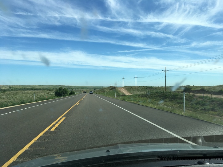
Desolate nothing Texas then turned into desolate nothing New Mexico with a few little towns dotted along the way.

Rural New Mexico roadside with blue Land of Enchantment welcome sign visible ahead on grassy shoulder Weathered brick building downtown showing faded mural of landscape scene, multiple highway route markers (64, 56, 412, 87) on pole Highway bordered by barbed wire fence with flat prairie grassland extending to horizon under blue sky Long straight divided highway through grassland with prominent mountain visible in distance under clear sky

Rest stops were rare, but the one in New Mexico was nice. It was definitely very windy in that area.

American flag and New Mexico state flag with yellow field and red Zia sun symbol flying on flagpole, building and clear sky visible Modern public restroom facility at highway rest area featuring peaked roof with exposed beams, horizontal siding, and stone foundation Rest area building with covered entrance area, stone foundation, horizontal siding, peaked roof with exposed rafters and high windows, information displays mounted near entrance Wide open prairie landscape view from rest area walkway, flat grassland extending to distant hills under blue sky, fenced area in foreground Official Scenic Historic Marker sign with New Mexico Zia sun symbol reading OVER LEFT SHOULDER SIERRA GRANDE describing extinct volcano at 8,720 feet elevation covering over 1,000 square miles Official Scenic Historic Marker with New Mexico Zia sun symbol displaying POINTS OF INTEREST map showing local attractions and landmarks in northeastern New Mexico Small red utility shed with corrugated metal siding at rest area, sparse trees and Sierra Grande mountain visible in background across flat terrain

The rest stop was a quick stop. It was back to desolate nothing again. At least we were going up in elevation and it became less flat.

Long straight highway through flat New Mexico grassland under blue sky with scattered clouds, distant hills visible on horizon Highway view with small isolated buttes and mesas visible on left side, flat prairie grassland extending to horizon, scattered white clouds in blue sky Highway approaching dramatic flat-topped mesa with layered rock cliff face rising on right, sparse desert vegetation and sage brush Straight divided highway through high desert plateau landscape, mesa formations visible on both sides, dramatic white clouds building in sky Highway through rolling grassland with red pickup truck ahead, puffy white cumulus clouds in blue sky, green forested hills flanking road Highway cutting through steep roadcut with exposed layered sedimentary rock formations and columnar jointing, pine trees covering upper hillside Mountain highway with yellow bighorn sheep crossing warning sign, metal guardrail along shoulder, forested hillside in background

We finally made it to Colorado! It was definitely a lot more scenic and mountainous here.

Welcome to Colorful Colorado state border sign at highway rest area, visitors taking photos near sign, forested mountainside in background Mountain highway with steep roadcut showing exposed sedimentary rock layers, guardrail on left, aspen and pine forest on hillside, distant valley view Winding mountain highway through roadcut with exposed stratified rock cliff on right, mixed pine and deciduous forest on hillside, blue sky with clouds Antique wooden farm wagon with large spoke wheels on display at rest area parking lot, forested mountains visible in distance under cloudy sky Distant view of snow-capped Rocky Mountain range on horizon across high desert plain, white semi truck parked at rest area in foreground Straight rural Colorado highway through flat grassland under partly cloudy sky, gentle rolling hills in distance, green grass on road shoulders Highway through rolling grassland with scattered white clouds, green grass verges, power lines visible, mountains in distance Highway through cut between grass-covered embankments, black pickup truck ahead on road, cloudy sky with dark storm clouds and mountains in background Highway descending into valley with black pickup truck ahead, dramatic cloudy sky, distant mountains and green agricultural fields visible on both sides Straight highway approaching overhead sign structure, rolling grassland terrain under dramatic sky with large white cumulus clouds and blue patches Highway through high plains under expansive sky filled with dramatic white cumulus clouds, scattered vehicles visible ahead in distance Motion-blurred roadside view with T-intersection warning sign, dark storm clouds building over mountains in background, yellow road striping visible

After a while of driving, the clouds threatened rain and eventually it did rain hard.

Straight highway under heavy dark gray storm clouds with white vehicle ahead, threatening weather conditions reducing visibility over flat terrain Highway with multiple vehicles traveling under dark overcast storm clouds, wet pavement indicating recent or ongoing precipitation Motion-blurred side window view of rural grassland with fencing, dramatic storm clouds mixed with patches of blue sky overhead Side view from moving vehicle showing metal highway guardrail, towering storm clouds with dramatic lighting, scattered rural buildings in rolling countryside Driving into severe storm with rain droplets visible on windshield, multiple vehicles ahead with lights on, extremely dark threatening storm clouds overhead

I know, "Riding the Storm Out," by REO Speedwagon was written about driving through a blizzard in the Rockies, so I had to play it as the weather worsened.

Car stereo display showing 14 Ridin' The Storm... by REO Speedwagon playing, Track 16/16, time 3:19, exterior temperature 55°F, viewed through steering wheel Heavy rain on windshield obscuring view of wet highway ahead, vehicle headlights visible through downpour, dark gray storm clouds with small break showing lighter sky Wet highway during rain with vehicles ahead visible, dark storm clouds overhead beginning to break, trees lining right side of road Recently wet highway with water puddles after storm, dramatic clouds breaking apart revealing more blue sky, flat-topped mesa visible in distance, concrete barriers flanking road

This eventually lead to some traffic jams, but surprisingly nothing close to what Austin would be, especially in the rain. Traffic actually kept moving and we didn't have a complete gridlock.

Highway with moderate traffic including distinctive orange Jeep Wrangler, blue sky emerging through clouds after storm, rolling grassland hills on both sides Multi-lane urban freeway with modern office buildings on left including distinctive cylindrical tower, moderate traffic flow, dramatic clouds overhead

I think a big part of not having gridlock is Denver appears to have planned for the growth. They have a 10 lane highway and it seems like traffic can cruise along pretty well there. I wish Austin would have something like this. It's kind of crazy that Austin has a much larger population, but doesn't have close to the infrastructure Denver has. I was definitely impressed with Denver!

Urban freeway continuing through developed area with multi-story office buildings, highway overpass bridge ahead, mixed cloud conditions showing improvement

When we finally got to Victoria's dad's house, it was definitely much colder and definitely a lot colder than we experienced that morning in Lubbock!

Car dashboard displaying 7,167 total miles, Trip 1 statistics showing 399.1 miles at 38.7 MPG with 96 miles remaining range, temperature 55°F, heading west, low oil pressure warning light illuminated

The drive itself wasn't horrible overall. Driving in the dark to Lubbock wasn't the most fun, especially with the bugs. Also, West Texas is very flat, which can be boring. I was happy to start seeing a change in scenery when I hit New Mexico and the snow capped mountains of Colorado were beautiful. It does seem like most of the drive is a whole lot of desolate nothing, but I guess that's better than being stuck in traffic.

See more blog entries here