Lake Superior Circle Tour Day 1: Duluth to Almost Sault St. Marie

In all my traveling around Lake Superior, the furthest east I have went is either Copper Harbor on the American side or Nipigon on the Canadian side. I have always wanted to see what was beyond that so I decided after visiting Wisconsin, I would do the whole Lake Superior Circle Tour.

I headed off to Duluth to sleep that night at the Wisconsin Welcome Center.

Black Ford Focus hatchback parked at red-painted motel with pine trees in background

The next morning, I woke up and had a quick look around.

American and Wisconsin state flags flying at night outside illuminated rest stop facility Welcome to Wisconsin Superior entrance sign with state logo featuring silhouette of person with paddle Open-air pavilion with stone pillars and covered roof at rest area during twilight hours

Getting an Anytime Fitness membership was one of the best things I could do. Besides being able to work out, there are a ton of them I can take a shower at when I’m on the road. I went to a Duluth one to get my morning shower.

Spirit Valley Mall entrance with tenant directory including Anytime Fitness and Lake Superior Physical Therapy

I topped off at the Holiday gas station where I35 starts. This is where I will complete the full circle. I also stopped here before when I did my border-to-border drive.

Holiday gas station with multiple vehicles at pumps under cloudy sky

I got a steak and egg burrito for breakfast.

Breakfast burritos package being held in vehicle interior

Then I hit the road to start my journey.

View through windshield at traffic intersection with pickup truck ahead under partly cloudy sky

I was going counter-clockwise so I went past the welcome center I stayed at.

Highway stretching ahead with forested areas on both sides under blue sky with white clouds

Lake Superior was constantly in view on the drive.

Lake Superior shoreline visible from roadside pulloff with overcast sky

I was going to go to Saxon Harbor, but the road was closed due to the rains washing it out. I had to take a royal leak so I ended up at another Wisconsin Welcome Center on the Michigan border this time.

Stone and concrete visitor center building with modern architecture surrounded by pine trees Wisconsin historical marker detailing iron mining history in northern counties from 1800s to 1960s

In the UP, things got a little hillier.

Two-lane highway cutting through forested northern Wisconsin landscape under partly cloudy sky

Eventually, I made it to Hancock. I stopped at Pat’s Foods, like I did the times before.

Pat's Foods supermarket storefront with fuel discount promotion banners

I bought a pasty since they’re a delicacy in the UP.

Pasty wrapped in foil alongside TruMoo chocolate milk bottle on car seat

I ate and enjoyed the awesome view.

Dramatic storm clouds gathering over highway with utility poles visible

I then drove to Copper Harbor and parked in the same spot as last time.

Marina harbor view with sailboats, docks, and waterfront buildings across the bay

I went on the dock. The views were pretty great!

Two sailboats moored at wooden dock with waterfront structures in background White sailboat with registration number docked at marina pier with pine trees visible on shore Inland harbor channel with forested shoreline, waterfront cabins, and docks under overcast sky Lake Superior vista with distant forested islands under partly cloudy blue sky Harbor view showing waterfront buildings, cargo vessel, residential structures, and sailboat under cloudy conditions

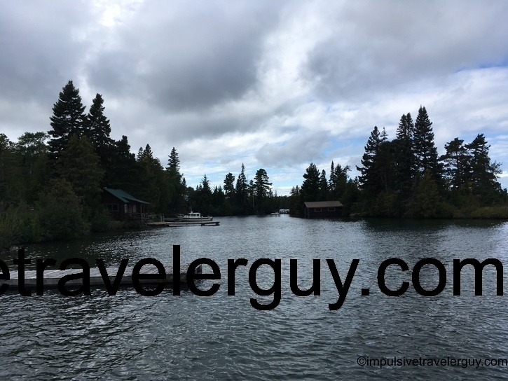
It was a bit windy and the waves were crashing in the distance.

The boat was also rocking.

When I was walking back off the dock, I was able to get really close to a seagull.

I then drove to the end of Highway 41.

Expansive Lake Superior view with multiple forested islands visible across blue water

I didn’t attempt to drive down the seasonal road like last time.

Byron Muljo Memorial sign display describing early Native American footpaths and US Highway 41 origins Seasonal road sign warning of no snowplowing by Keweenaw County Road Commission mounted on utility pole Forest service directional sign indicating Horseshoe Harbor at 1.9 miles and High Rock Bay at 7.5 miles Yellow road ends warning sign with two red diamond markers on gravel forest road

There appeared to be a mountain bike race, so the last thing I wanted to do is dodge a bunch of bikes.

Red mountain bike race in progress warning sign posted on tree along dirt trail

Then again, the race may have been over.

Parking area with sedan and white pickup truck carrying bicycle rack surrounded by birch and evergreen trees

When I started going further south, I saw some scenic views of the lake.

Highway view showing curved road with maroon SUV ahead and rest area parking lot to left Lake Superior roadside pulloff with dramatic cloudy sky over grassland and water

I noticed there were a bunch of old cars that must have also been doing the Lake Superior Circle Tour but in the opposite direction.

Driver's view of two-lane highway following traffic through forested corridor under bright cumulus clouds

Later in the day, I had to take another leak. Michigan has a ton of roadside parks that the old school outhouse pit toilets.

White metal dumpster enclosure with green roof at wooded rest area

There was a walkway to view the lake.

Elevated wooden boardwalk pathway leading through dense forest to observation platform

Since this was up in the hill a bit, the views were pretty good.

Grand Island Harbor interpretive display showing map and historical information about island communities Lake Superior harbor overlook framed by tree branches showing forested islands and water Scenic view through maple tree canopy of Lake Superior with distant wooded shoreline under overcast sky Similar lake vista showing water expanse and forested shore with roadway visible below viewpoint

I found a modern rest stop to park for the night and sleep.

Illuminated log cabin rest stop building with American flag photographed at night

It even had modern technology problems on the weather information computer.

Computer monitor displaying American Megatrends BIOS setup screen with system boot information and hardware details

The first day was a pretty long drive. I basically scaled the whole South Shore of Lake Superior in a day. I ended up about an hour out of Sault St. Marie before I decided to stop for the night.

See more blog entries here