54 Counties in Indiana, Kentucky, and Illinois

Trying to plan a trip in the spring has been challenging. The weather has been very volatile and extreme. It has been unseasonably warm here, but there's always the threat of snow. To the south, there are tornadoes. To the west, it has been a paradox. There's either a high fire risk or blizzards. It seems like there isn't a great place to go right now.

I figured Indiana would be a sweet spot. It's a bit north of the most active tornado areas. It's south of where the winter storms usually hit this time of year. As far as I can see, there are no fire risks. It is also one of the closer states to Wisconsin.

I had 56 counties left to complete Indiana, so that was my goal. I planned the trip a few weeks in advance, hoping the weather would hold out. I took the Friday before and also part of Monday off. I kept watching the forecast. It seemed like everything would fall into place.

I packed up the car the night before. I was ready to hit the road around 8 AM on Friday.

Car interior showing Chex Mix Family Size snack bag, water bottle, and black backpack on passenger seat View from driver's seat looking into rear passenger area of car with gray interior

The first county in Indiana was a little over four hours away. I took the Illinois toll road to make the best of my time.

Highway toll plaza overhead sign displaying OR PAY ONLINE with 15 MPH speed limit

Before you know it, I was in Indiana! Interstate highway with overhead INDIANA welcome sign spanning across lanes

I stopped at this cool rest stop. It was modern and was probably built in the last few years.

Indiana welcome center with large dimensional INDIANA letters and Welcomes you text on modern building facade Interior of Indiana welcome center showing metal bison sculptures along walkway beneath industrial-style ceiling structure

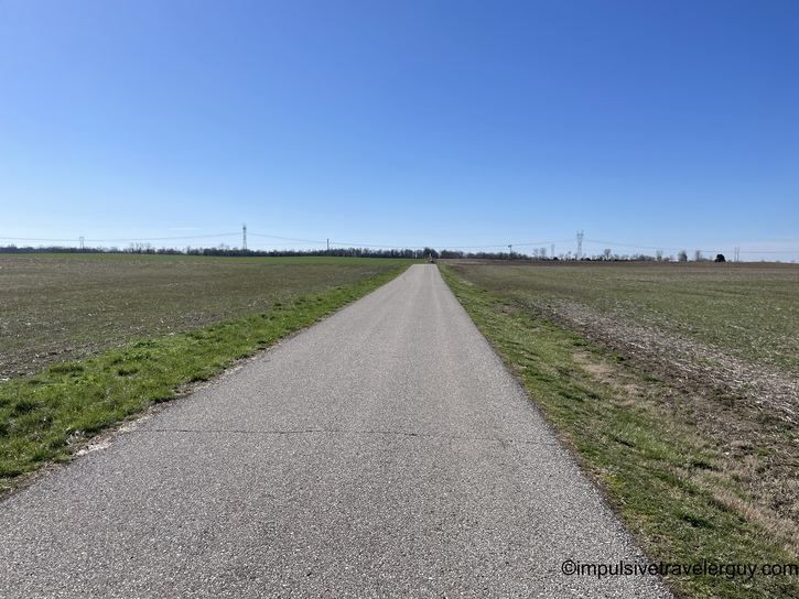
Soon I was in the area of flat nothing.

Two-lane rural road stretching through flat farmland with utility poles along roadside

My first stop was White County.

Modern three-story courthouse building with dark accent panels, landscaped front lawn, and flags

Up next was Carroll County Classical Beaux-Arts courthouse with white stone facade, ornamental details, and manicured lawn

I was happy they had higher speed limits on some of the highways.

Straight rural highway with SPEED LIMIT 60 sign and farmland on both sides

Those higher speed limits got me to Cass County.

Contemporary courthouse building with clock tower feature, brick and white exterior panels

On the way to my next county, things got interesting. It seems many people have forgotten how to be patient and obey the rules of the road. I got behind a truck trying to turn left on a busy, divided highway. It was obviously a challenge, and we had to wait a while. Some people took it upon themselves to start going around the truck, causing a traffic jam in the median.

I (as patiently as I could) waited for the truck. They were eventually able to turn after the traffic jam, and I got to go.

View from behind yellow Estes moving truck on highway during travel

That was a bit of a delay, but I soon made it to Howard County.

Indiana government building with Art Deco styling, stone monument marker, and bronze worker statues in foreground

I saw a cool bridge on the way to Miami County.

Blue steel truss bridge spanning river, viewed from approach road Grand Classical Revival courthouse with white painted exterior, prominent columns, and arched windows

I drove into more flat nothing on the way to Wabash County.

Narrow rural road through agricultural fields with power lines overhead Victorian-era courthouse with ornate clock tower, red brick with stone trim, currently with construction scaffolding

Soon, I was in Grant County.

Neoclassical courthouse with grand columned portico, white stone exterior, and symmetrical design

You could tell they were hit with some heavy rain earlier on the way to Blackford County.

Rural road alongside flooded field or wetland, water spray visible on windshield Romanesque Revival courthouse with prominent clock tower and rough-cut stone exterior, covered in restoration scaffolding

Up next was Jay County.

Neoclassical courthouse with cream-colored stone facade, columns, and multiple American flags displayed on front lawn

For some reason, a dump truck decided to block the road on the way to Randolph County. I had to take a side road to get around them.

Road maintenance truck parked on shoulder of rural two-lane road with farmland in background Victorian Italianate courthouse with red brick, white stone quoins, central cupola, and slate mansard roof

I swear it seemed every roadblock (literally) was getting in my way to Muncie. It appears that some strong storms must have come through a few days before. Strong enough that they closed down roads to repair power lines.

They had the roads closed but no detour signs. I ended up going down some back roads in hopes of finding my way back to an open main highway. I ended up following a truck down these back roads. The roads to return to the main highway were closed, so I kept driving. The truck I was following had Indiana plates, and I could see they were doing the same thing and knew where they were going.

View through rain-spattered windshield of rural road with vehicle ahead and flat farmland on both sides

I kept following until we found that we could turn on a main highway again.

Rural intersection with stop sign, white pickup trucks, and small town residential area in background

After all of that, I got behind a guy hauling a dryer. He was doing well under the speed limit.

Two-lane highway with truck ahead, surrounded by agricultural fields under partly cloudy sky with sun visible

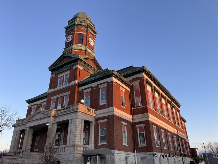
Eventually, I reached Muncie, where the Delaware County Courthouse is.

Mid-century modern government building with tan panels, raised on columns, American and state flags flying

Thankfully, the roads to Madison County were open.

Tree-lined residential street view from moving vehicle showing suburban neighborhood Brutalist-style Madison County Government Center and Courts with brown panels and reflective glass facade

The sky had some cool colors in Henry County.

Victorian Italianate courthouse with prominent clock tower photographed at dusk with colorful sunset sky

For some reason, despite my phone saying "5G," it wouldn't work for Google Maps at the courthouse. I had to drive down the road to the Kroger.

Shopping center parking lot at twilight showing Kroger and VIP Nails storefronts with parked vehicles

I was then able to find the nearest rest stop. Luckily, it was very close to my next county.

Google Maps mobile screenshot showing rest stop search results near Indiana Welcome Center and Connersville area

I drove into the dark and eventually made it to the rest stop.

Interstate highway driving at dusk with vehicle headlights and taillights visible ahead on multi-lane road

My first order of business was getting something to eat. I grabbed the Costco bag of mixed nuts.

Hand holding open bag of Kirkland Extra Fancy Unsalted Mixed Nuts in dark vehicle interior

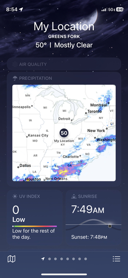
I checked the weather and saw that I was probably smart visiting Indiana. It was clear, and further south, it looked like they had some strong storms.

iPhone weather app displaying Greens Fork location at 50 degrees with precipitation radar map showing Midwest region

I then set up my fan and light.

Car dashboard at night with clip-on BEBRAS fan featuring blue LED ring light mounted above phone holder

I researched places to get breakfast.

Google Maps mobile search for restaurants breakfast near showing filtered results including Frisch's Big Boy

I then realized the sunrise was a bit later, so I got a good idea of when to start in the morning.

iPhone sunrise app showing 7:49 AM sunrise time with arc diagram and daylight statistics for longest day June 20

I then went inside to brush my teeth and get ready to sleep.

Rest area building illuminated at night with white and tan horizontal siding, American flag, and parking lot lights

The vending machine inside had some interesting options. You could get sardines or a Hot Wheels car. Then again, I often eat stinkier foods when I'm out on road trips. I can have those foods, and Victoria doesn't have to smell them. The Hot Wheels car is perfect for an antsy child (been there, done that).

Vending machine fully stocked with various snack items including chips, crackers, candy, and beverages arranged in rows

After getting ready to sleep, I went back out. I knew I was in the rest stop's sleeping area, with a camper parked close to my car.

Rest area parking lot at night with white sedan parked, small RV in background, overhead lighting, and lawn areas

The following day, the windows were pretty foggy. It took a while to defrost them.

Silhouetted view from car interior showing rearview mirror and dashboard-mounted fan against frosty windshield

I was soon on the road.

Night driving on interstate highway with headlights illuminating road and vehicle taillights visible ahead

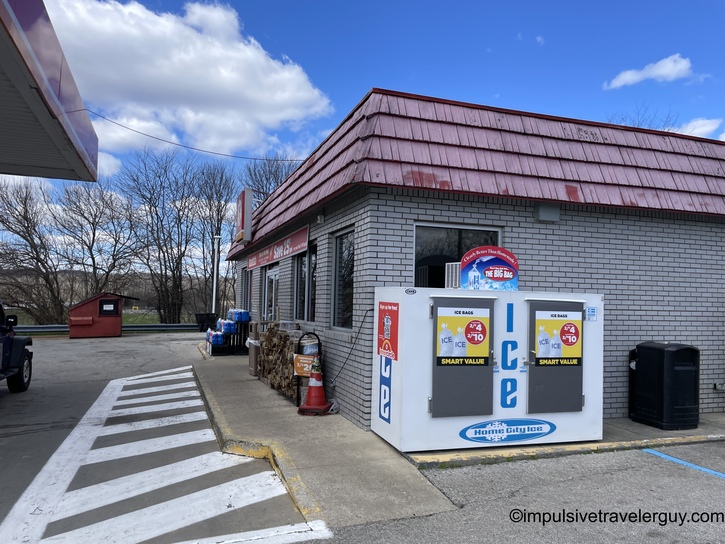
I got gas at this older-looking gas station.

Gas station at night with National Food convenience store, fuel pump island, and stacked firewood for sale

I then went to the Big Boy restaurant. I see I was the only one there at the time.

Frisch's Big Boy restaurant exterior at night with illuminated red windows and iconic Big Boy mascot statue Frisch's restaurant interior showing retro-modern dining area with booths, tables, spherical pendant lights, and counter seating

I got the Breakfast Boy Sandwich and some Dr. Pepper.

Restaurant table with hamburger topped with fried egg on red-rimmed plate, cola with red straw, and napkin-wrapped utensils

You can tell Indiana is a bit of a Southern state with its to-go drinks. That was never a thing in Wisconsin. I first learned about it when I traveled in The South. I appreciate the fact they give you a soda for the road.

Hand holding Frisch's Big Boy branded drink cup in car with steering wheel and dashboard controls visible

I sipped my Dr. Pepper and then made it to Wayne County.

Romanesque Revival courthouse with light stone exterior, cylindrical corner tower, and arched windows photographed at dusk

On the way to Union County, some nice colors were in the sky.

Rural two-lane highway at dawn with Route 27 sign visible along tree-lined road Romanesque Revival courthouse with prominent clock tower, stone construction, ornate detailing, and white gazebo on grounds

It got really foggy for Franklin County.

Foggy rural highway at dawn with flat farmland barely visible through dense morning mist Classical Revival courthouse with central dome and columned portico shrouded in heavy fog

Next was Fayette County.

Red brick Richardsonian Romanesque courthouse with distinctive cylindrical tower topped with conical metal roof and clock

Everything was much clearer for Rush County.

Straight rural road through agricultural land with water tower visible in distance and harvested cornfields alongside Richardsonian Romanesque courthouse in light limestone with central clock tower, red tile turret roofs, and elaborate stonework

I was soon in Hancock County.

Richardsonian Romanesque courthouse with twin rounded corner towers, central clock tower, American and state flags, bronze statue at entrance

Then came Shelby County.

Art Deco Shelby County Court House with vertical design emphasis, tall windows, cream stone facade, and geometric detailing

More driving got me to Decatur County.

Highway view showing junction signs for US Route 27 South and State Route 42 with rural farmland surroundings Red brick Victorian courthouse with ornate white stone clock tower featuring decorative trim and prominent timepiece

Ripley County was following this.

Highway cut through hillside with tall exposed limestone rock face on right side and wooded slope on left

I was also smart to keep my eyes open for good photo spots and not drive past an open road.

Long straight gravel path stretching through flat agricultural fields under clear blue sky

Following this Jennings County.

Victorian Italianate courthouse with red brick, white stone quoins, copper-green mansard roof features, and prominent clock tower

I drove down some nice curvy roads to Jefferson County.

Two-lane highway with Indiana State Route 7 sign visible along roadside embankment Victorian Italianate courthouse with red brick construction, clock tower, arched windows, and large tree in foreground

I then drove through a cool rock tunnel-looking bridge.

Historic stone arch railroad bridge or tunnel with rough-cut limestone construction and curved road warning sign

Following that was Switzerland County.

Federal Revival courthouse with red brick, white painted clock tower with cupola, and symmetrical facade

The roads were curvy and had lots of hills.

Winding road through bare winter forest with tall deciduous trees on both sides

Soon I was at Dearborn County.

Modern neoclassical courthouse with grand columned portico, light stone facade, and contemporary glass addition

That has a library with free WiFi! Public library building with red brick facade, large arched entrance labeled LIBRARY, and stone trim details Library interior showing service desk, classical columns, open floor plan with tables, and staircase to upper level

You know what that means? An internet speed test!!!!

iPhone Speedtest app screenshot showing 87.7 Mbps download and 93.0 Mbps upload speeds with Honda dealership advertisement

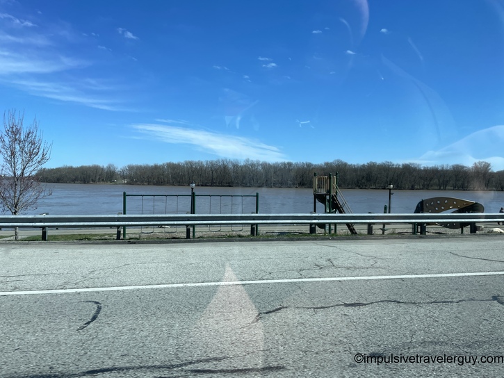
On my way out, I saw this boat dock.

River view with boat launch facility, wooden dock structure, and guardrail along shoreline under blue sky

I then made it to Ohio County, which crosses the state line.

Historic Ohio County Court House with monumental white columns, red brick construction, and historical marker in front

After going through more curvy hills, I made it to Oldham County.

Winding rural road with yellow winding road sign and 35 MPH speed limit through hilly terrain Red brick courthouse with central cupola topped with bell tower, symmetrical window arrangement, and metal equipment boxes on lawn

On my way to Trimble County, I stopped by Casey County because I needed gas. I forgot to take a picture of the courthouse. I was there for probably a good ten minutes, but I wasn't thinking about it.

Small white commercial building with red metal roof, central entrance, and parking lot

I soon made it to Trimble County.

Federal style red brick courthouse with white trim, pediment detail, and bare trees surrounding building

After that, I had time to kill and to wait for things to back up. I looked at the map, picked the closest Kroger, and went there. I had to take off my shoes and socks so they could dry. It was getting cold, and they were still a bit wet. I didn't even think about what I put on that day when it was 50 degrees and dry. Now it's 40 and pouring rain.

Overhead view of person's feet wearing black sandals with lime green insoles on car floor mat, holding bottled water

Once everything dried up, I made my way to Henry County. It was still raining and overcast.

Red brick courthouse complex with large mature tree in foreground casting shadows on lawn

I made it through to Anderson County. Interestingly, there were three Anderson Counties in Indiana and Kentucky!

Downtown street view with multi-story brick buildings, traffic lights, parked and moving vehicles at intersection

I was feeling tired. I needed to get home for Easter and wanted to attend mass in the morning. I'm not sure if I'd make it back if I napped. I drove around and finally headed to Frankfort County. I kept seeing these white trees everywhere and thought they looked cool.

Modern brutalist building with tall arched openings surrounded by white flowering trees in full spring bloom

Upon getting to the courthouse, it was closed. It was a Saturday, and I saw it would also be closed tomorrow. I guess Jesus doesn't get that off! I realized there was a Church named St. Francis of Assisi open right now on the Masstimes app. I headed there to attend mass and planned to come back to the courthouse.

Google Maps notification screenshot showing St. Francis of Assisi: Church is closed today with map interface below

On my way there, I drove over this cool bridge. I was glad to see Martin Luther King Jr. honored. It was more civil-rights-minded individuals like him, not people who wanted to blow things up, that made things happen.

View driving through white painted steel truss bridge with Martin Luther King Jr. memorial sign overhead

I then got into a neighborhood and immediately realized I was not in the best area. It felt sketchy but didn't necessarily seem unsafe.

Urban street intersection with traffic signals, extensive overhead power lines, shops, and pedestrians crossing Residential street with multiple cars parked along curb beneath large mature shade trees, houses in background

I got there and saw I was the only white person there. I soon learned that this was in a predominantly Black neighborhood. I thought they had changed the time on me for mass. The lady at church told me no, they don't have mass here on Saturday night. The Masstimes app had the wrong information.

Masstimes.org mobile app showing filtered search results for Catholic mass times in Louisville, Kentucky area

I then looked for churches with mass times. I saw there were some close by. I then headed to Bellarmine University Church to catch mass.

iPhone lock screen displaying 6:01 time, Saturday March 16 date, with gradient orange and blue wallpaper Gothic Revival limestone church with prominent bell tower, large pointed arch window, congregation members outside

After mass, I made it back to the Franklin County Courthouse. They need a facelift!

Modern cylindrical glass courthouse with reflective blue facade, classical tower element, and columned entrance

I then drove back to Indiana to continue my trip.

Multi-lane interstate highway with overhead exit signs, light traffic, and Indiana welcome billboard ahead

I got to Scott County.

Classical Revival courthouse with tan brick and stone construction, prominent American flag on tall pole

Then came Clark County.

Single-story brown brick government building with three flagpoles flying American and state flags, parking area

The sun was really setting, and I was getting hungry.

Rural two-lane highway at twilight with dramatic cloud formations, exit sign, wooded hillsides flanking road

I then started searching for a rest stop.

Google Maps mobile interface showing Rest Area I-64 Westbound with rating, photos, and navigation options

Before I went to the rest stop to sleep, I needed to back up my photos. The rest areas didn't have Wifi, so I had to find a place with good WiFi.

Internet speed tests are the best!!!

Speedtest mobile app results displaying 103 Mbps download and 23.9 Mbps upload speeds with advertisement

These were the photos I needed to back up.

Photo backup app interface showing progress bar and thumbnail grid of recent photos from March 2024

I then got food to eat.

McDonald's meal on tray with wrapped burgers, small fries in red container, iced beverage, and wrapped utensils

I slowly ate while my phone kept backing up. I was there for nearly two hours when everything was done.

Cloud backup app showing completed photo upload with thumbnail grid of food and location photos

I then headed to the gas station and filled up.

Gas station fuel pump number 6 at night with white car refueling, illuminated convenience store in background

I was soon at the rest stop. Unlike the rest stop I stopped at upon first entering Indiana, this one looked like it was out of the 70s.

Interior of a wood-paneled rest stop or visitor center showing men's and women's restroom entrances, information boards, vending machines, and a water fountain station

I appreciated that I was able to fill up my water jug easily.

Close-up of a hand filling a water bottle at a stainless steel water bottle filling station

Another travel tip I reaffirmed is to find an area with rest stops on both sides of the road. After I had filled up my jug, I walked back to my car. A few stalls down, there was a rusted-out minivan parked. The guy was loudly swearing at someone on the phone. After he abruptly hung up, he started asking me for money.

This didn't seem like a great situation, so I put in directions to the other rest stop.

Navigation app screenshot displaying route on Interstate 64 West with 7 minutes remaining and arrival time of 10:43 PM EDT

That one was a lot calmer.

Night photograph of an illuminated rest stop or visitor center building with glass front facade and American flag

I checked when sunrise would be and made a plan for the morning.

Sunrise app screenshot showing sunrise time of 6:55 AM tomorrow with daylight duration chart and solar timing information

It was a quiet night with me, and a not-rusted van was parked for the night.

Silver Ford Focus sedan parked at dawn or dusk with colorful orange and blue sky in background

I got going for the day and realized that my car had turned over exactly 165,000 miles.

Vehicle dashboard display showing Trip 1 statistics: 9.4 miles traveled, 31.7 MPG fuel economy, and 165,000 mile odometer reading

My first courthouse of the day was Perry County.

Single-story municipal or civic building at dawn with central cupola, columned portico, and symmetrical wings extending from center

I then snuck into Kentucky and got to Hancock County.

Road view approaching a town with bare trees, road signs, and buildings visible on hillside Red brick neoclassical courthouse with white columned portico, central cupola, and symmetrical design photographed at dawn

I was then back in Indiana and soon at Dubois County.

Rural highway view with MORGAN location sign visible on roadside among bare trees Gray limestone classical courthouse with prominent clock tower, tall columns at entrance, and three-story design

I stopped to enjoy some scenery before getting to Martin County. The natural scenery was nice, but the courthouse looked like a bomb shelter.

Scenic overlook view through bare winter trees showing rolling forested hills in the distance Brutalist concrete block civic building with American flags, featuring minimal ornamentation and flat roofline

It appeared that Orange County was getting a nice facelift.

White neoclassical courthouse with columned entrance undergoing renovation with extensive scaffolding surrounding cupola and dome

It was open roads to Washington County.

Straight rural highway view with rolling farmland and hills on both sides under clear blue sky Ornate Romanesque Revival courthouse built of carved limestone with prominent cylindrical corner tower topped by conical spire

Soon, I was in Jackson County.

Historic brick courthouse with central clock tower and military tank memorial displayed on front lawn

More driving got me to Lawrence County. It was pretty packed around that courthouse square! Rural highway view with WEST 50 road sign, bare trees lining road, and open farmland Beige neoclassical courthouse with symmetrical facade, arched windows, central entrance with steps, and formal landscaping Downtown street scene showing parked cars along sidewalk, storefronts, and pedestrians on a sunny day with blue sky

I then made it to Monroe County.

White neoclassical courthouse with ornate dome, columned entrance, and symmetrical facade viewed through bare trees with bike racks in foreground

The roads started to get windy again when I started driving.

Winding paved road through bare winter forest with yellow curve warning sign on roadside

I found a parking spot near the Brown County Courthouse. I didn't realize you had to pay until after I parked. The parking attendant informed me of this as I was getting out of my car. I said I would leave and find another spot since I was just going to take a picture of the courthouse and leave.

He then said, "I'm here to charge the all-day people. I can't charge you for that! Go get that picture!" I quickly did that and then hit the road.

Parking lot with red sedan, red pickup truck, and dark Jeep SUV, with small building and blooming tree in background Red brick civic building with white clock tower, external metal staircase, and gabled roof design

Up next was Johnson County.

Victorian-era red brick courthouse with white limestone trim, prominent central clock tower, ornate architectural details, and green lawn

One thing I've found is most of Indiana is a dead zone for good gas stations. Maybe I'm spoiled with Kwik Trip in Wisconsin. It seems finding hot grab-and-go sort of food is a challenge. The Marathon stations are everywhere there and are sorely lacking.

I got gas at one but didn't find any hot food.

Marathon gas station price sign displaying fuel prices for regular and diesel with digital display board

I then made my way to Morgan County.

Red brick Victorian civic building with tall corner clock tower, white limestone trim, arched windows, and front parking lot

It seems the best you'll get in most parts of Indiana is a Circle K. Small commercial building with metal siding and prominent blue and white ice vending machine in foreground

They have a hot dog roller and some heated food. Convenience store interior showing hot food service area with hot dog roller, pizza warmer, condiment station, and fresh toppings bar

I was really craving pizza but didn't see it. I settled for some sandwiches instead.

Two wrapped breakfast sandwiches in red and white branded paper sitting on lap in car, one labeled as chuckwagon style

My GPS then took me on some slower 40mph roads.

Highway view from vehicle showing two-lane road with speed limit 40 sign and bare trees lining both sides

I saw a gas station that had pizza. I guess I should have waited a bit.

Small rural gas station with cream-colored building and blue fuel canopy visible across roadway

Shortly after, I was in Putnam County.

Gray limestone neoclassical courthouse with prominent columned entrance, three stories, ornate cornice, and rooftop American flag

It was nice blue skies to Owen County.

Highway view through windshield showing two-lane road under dramatic cloudy sky with bare trees and farmland Beige neoclassical courthouse with central domed entrance, tall columns, symmetrical three-story design, and manicured landscaping

Then came Greene County.

Red brick civic building with square clock tower, limestone base, arched entrance, and military artillery memorial piece on lawn

Things started to cloud up on the way to Sullivan County.

Rural highway view under dark storm clouds showing two-lane road with speed limit sign and bare trees Large beige limestone neoclassical courthouse with columned perimeter on two levels, ornate cornice, and corner lawn location

The sky was trying to peak through the clouds in Knox County.

Ornate white courthouse with dual towers including clock tower, arched entrance, multiple stories, statue niches, and grand front staircase

Daviess County was still a bit overcast.

Gravel rural road with puddle and ROAD MAY FLOOD yellow warning sign, bare trees and farmland under cloudy sky Gray limestone neoclassical courthouse with columned entrance viewed through chain-link construction fencing under dramatic cloudy sky

Up next was Pike County.

Tan neoclassical courthouse with three stories of tall windows, American flags flying, bare tree and white war memorial monument in foreground

I was soon in Illinois.

Highway view at dawn or dusk showing overhead green directional sign with bare trees silhouetted against gradient sky

Since it was getting dark, I was starting to try to figure out where I wanted to sleep. I could drive straight through, but I would have gotten home at about 2 AM. I called Victoria, and we started talking.

I looked at the county signs and realized I was in Lawrence County. If I weren't cutting my itinerary short, I'd visit this county after Crawford County. I looked things up and realized I was only a few minutes away from the courthouse. I changed the directions from the Crawford County Courthouse to the Lawrence County Courthouse.

Red brick Victorian courthouse with ornate clock tower, limestone trim, and three stories viewed from corner angle in evening light

I then made it to Crawford County before it got dark.

Navigation app screenshot showing IL-1 N route with 24 minutes remaining, 22 miles to destination, arrival time 7:12 PM Red brick courthouse at dusk with triple-arched entrance, clock face, and Civil War cannon memorial on front lawn with flags

I then wanted to get my bearings and also back up my phone a bit. I figured I could get good WiFi sitting outside an AT&T store.

AT&T retail store exterior at dusk with illuminated blue globe logo and white lettering on storefront

I guess I was wrong. I wasn't going to try Pizza Hut's WiFi, but I guess that was an option.

iPhone Wi-Fi settings screen displaying available networks including multiple Pizza Hut and shopping mall hotspots

I then went to Huck's. This gas station chain is a lot nicer. I wish they'd move further east in Indiana. I think they'd clean up the competition compared to those crappy Marathon stations.

Gas station at night with white car refueling at pump, Godfather's Pizza Express and Huck's convenience store illuminated in background Convenience store interior showing refrigerated Big Fresh food section, candy display aisle, and decorative welcome signs

I started planning my route back. I found some rest stops along the way that would be good stopping points.

Google Maps screenshot showing rest stop search results with multiple rest area locations marked between Rockford and Chicago

I also got some pizza! Personal pan pizza in white box topped with melted cheese, sausage, mushrooms, and other toppings with golden browned crust

The GPS decided to take me down some really stupid back roads. I found out it saved me about 1-2 minutes versus taking the US Highway. Google Maps seems to be getting dumber and dumber over time! Dark rural road at night with only vehicle headlights illuminating empty pavement ahead

I made it to the rest stop and realized I had about 3.5 hours to get home.

Google Maps navigation displaying 3 hour 25 minute route covering 220 miles from current location to Belleville with traffic information Modern civic building at night featuring angular peaked roof, illuminated glass entrance, and curved walkway approach

I also checked the weather and saw I was in a nice sweet spot.

Car interior view showing red fleece blanket covering front passenger seat area with steering wheel visible

I fell asleep and got a decent night's sleep. I found it was cutting it close in terms of warmth with my blankets. It probably would have been an uncomfortable night if it had been any colder.

Driver's view of green painted steel arch bridge spanning highway with clear sky above

I then hit the road and drove over the famed Abraham Lincoln Bridge.

Traffic scene showing large white agricultural fertilizer spreader with oversized tires following dark SUV on suburban street

I made it to Wisconsin. I didn't need a road sign to tell me I was there.

White dog with black spots investigating items on entryway floor including gray mat, water bottle, and bag near doorway with white laundry basket visible

Shortly after, I made it home. Someone was so elated that I could barely put my stuff down with her jumping on me.

Map of United States showing county-level travel coverage with cyan-highlighted counties concentrated in Texas, upper Midwest, and scattered areas across Great Plains and Mountain West

I ended up getting 54 counties, so I'd say it was a successful trip. I do know I need to slow down a bit so I don't miss counties. I'm glad that the county I missed is on the Kentucky border. It'll be a good launching point for a future trip.

I'm glad the weather held out. It seems that has been the most significant factor to plan around lately. I'll have to keep that in mind for my next trip. Maybe that next trip will finally complete the rest of the counties in Indiana!

See more blog entries here