It’s been almost a year-and-a-half since I’ve been to Thunder Bay. That’s right before I started my current job. Obviously, when starting a new job the vacation time you get is limited. The little bit of vacation time I did have was spoken for with the second wedding reception in Wisconsin.
In early March of this year I was excited. I had just moved back to Wisconsin. Instead of being a 24-hour drive from Thunder Bay it was only an 8-hour drive. You know me, that’s not a terrible amount of distance. I was pumped that I’d finally be able to see my Canadian friends. We all know what happened come mid-March. BAM! COVID shut everything down and it hasn’t been the same ever since.
For the first few months of COVID, I pretty much became a hermit. In some ways it was nice after the excessive amount of travel I did visiting all 254 counties in Texas. By the time summer rolled around, I realized I was going to waste a perfectly good summer by sitting around and not traveling.
As time went on and we got to know more about the beast that is COVID, I realized I could take some basic precautions to travel safely. I’d avoid going into places if I didn’t need to go inside. I’d wear a mask inside or in the outdoors when I was in close proximity of people. I’d either wash my hands or hand sanitize often and do my very best to practice the 6+ feet of social distancing.
The main issue still at hand was border restrictions. How could I see my Canadian friends without actually crossing the border? With a little knowledge of some basic geography, I knew that Pigeon River formed the border between the United States and Canada. Surely there must be a place narrow enough that we could each sit on our respective sides and talk across the river!
I started doing some research and realized that many of the places required a bit of a hike on either side. After scouting out the map, I found that the most convenient place for both sides to drive up to was the old border crossing. The bridge had since been removed, but it appeared this was our best bet.

I made plans with my Canadian friends and also called border patrol on both sides. I know when you have two parties meeting on both sides of the border at the same time, it can be suspicious. The last thing I wanted to happen is to be surrounded by border patrol because I set off some random sensor.
On Friday, I first stopped to get some ice for the cooler and then hit the road.


After close to 5 hours of driving, I finally made it to Duluth. I was able to get out of the car and get my first full glances of Lake Superior.

Some big storms were rolling so I made sure to get back on the road fast. I gassed up at the unattended Sinclair station and then hit the road.

I tried to sleep at a wayside but some weirdos kept flashing their flashlight around their vehicle and towards my car for over an hour. This wayside had no electricity and was otherwise pitch black. It creeped me out so I hit the road to get out of there.
I found the first public parking lot along the way, which appeared to be Sugarloaf Cove. I parked the car and fell asleep. No weirdos in this parking lot and I was able to get a good night’s rest. I woke up in the morning and realized this might be a good place to explore.


I realized there was a parking fee so I paid that fee and knew I had to get my money’s worth out of exploring.


The first order of business was finding a bathroom. Luckily, they had a porta potty with one of the most interesting hand washing stations I have seen.

A little bit of walking down the trails got me to some awesome views of Lake Superior.


As I kept driving north, I’d stop to take pictures of interesting things along the way like this guy’s house that had some very unique landscaping to it.

There were also other good places to stop to get some good views of the lake.


Before you know it, I was to Old Highway 61!

It’s hard to believe this road was a U.S. highway at one time. There were a lot of hairpin turns. I could only do about 30mph (50kmh) on it.
It took me about half an hour to get to the old border cross, but there it was!

I had a few hours to kill before my friends would meet me on the other side. I fired up the camp stove and made some bacon and eggs for breakfast.


I sat back and enjoyed the scenery. Everyone once and a while, a car would pass buy. I wasn’t sure if it was locals checking out what was going on or people like me exploring.

After a while, I heard a little rustling from the other side. It was about 45 minutes before we had planned to meet, so it was a great surprise, but there were my friends Ryan and Neal!

I cracked open one of my non-alcoholic beers and said, “Cheers!”

Neal was able to get an awesome picture of me with Ryan’s camera from the Canadian side.

We talked a bunch and every once and a while a car would come by. One of the cars decided to stop. This couple decided to investigate what was going on, especially since they were from Wisconsin and saw my Wisconsin plates.

They thought at first that I was talking to some random people across the border. When I said I knew the guys across the border and we planned to meet at this location, their jaws dropped. I caught the guy’s name was Ryan so I made sure that Ryan (in Canada) said hi to Ryan (in the U.S.).
After the couple had left, I talked with Ryan and Neal a little bit more. The timing was perfect as they had to get going and my friend Daniel then came to visit. I cracked open another non-alcoholic beer and we talked for about an hour.

In the meantime, the RCMP decided to pay Daniel a visit. I saw a lot of pointing by the Mountie and I was wondering what was going on. After they left, Daniel told me they were actually giving him some tips and better places where we could do this next time.
I know when I called the Canadian border guys and let them know about the trip, they were also super helpful and gave me some tips. They suggested that the old border crossing probably wouldn’t be optimal for talking and thought we might be able to wave at each other, but not hear each other.
In the whole scheme of things, we did have to raise our voices a little, but we could carry out a conversation. It turned out way better than I thought it would!
Daniel and I talked for about an hour and then we said our goodbyes. The whole experience was amazing and I was glad I was able to see my Canadian friends after all this time! I hit the road and made my way back Grand Portage.


I went to Grand Portage State Park to scout out some of the other locations that we could do this next time. Maybe there was somewhere a bit better. The parking lot was packed!


I hiked back and found some narrow spots along the river that might work.


I then made my way to check out High Falls.


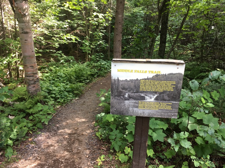
I was told that Middle Falls was a good spot overall, but was “a bit of a hike from the American side.” I started that hike. It was more than “a bit of a hike.” It started as a relatively decent trail, but when it turned into almost rock climbing, I decided to turn around since I knew I had another mile or two to go. I also wasn’t exactly wearing hiking shoes so walking on pointed rocks wasn’t the best idea.


After a little hiking in nature, it was time to get back to civilization. I started heading south and checked out Grand Marais. It was also packed!


Being that I didn’t want to hang around crowds too much, I hit the road again. I’d occasionally stop to get views of Lake Superior or just see some of the cool things along the way.


Another day of exploring was complete. I found a wayside right outside of Duluth to stop at and call it a night.

The next morning, I headed into Duluth. Judging by the cranes, there’s a lot of growth happening there!

I stopped by where my buddy used to live (he has since moved back to our hometown of Marshfield) and enjoyed the view there. This brought back a lot of memories. Prior to my “I’m bored with Marshfield so I’m moving across the country to Austin” stage, this was in the “I’m bored with Marshfield, so I’m going to visit places outside of Marshfield” stage. I spent a decent amount of time in Duluth while I was looking to get out of Marshfield for the weekend.


I didn’t hang around for long though. I got in the car and then drove around a bit before heading to Canal Park.


I had actually planned to spend the night in Grand Portage, so I was half a day ahead of where I planned. I re-calibrated my trip to include driving across Wisconsin to the Upper Peninsula of Michigan before heading back to Madison.
I took WIS-13, which hugged the shore of Lake Superior. I made the occasional stop for views of the lake and to eat a little fish along the way.


My last stop before I hit Michigan was Saxon Harbor. This place brings back from memories of my buddies and me going camping right on the lake. The interesting thing is the spots we camped at are now day use only.


Once I left Saxon Harbor, it was only a few miles until I was in Michigan. I drove Lake Superior Road until I got to Little Girls Point.


I knew I was starting to get limited on time, so I headed to Ironwood, Michigan.


Since Ironwood, Michigan borders Hurley, Wisconsin, I was soon back in Wisconsin!


Now it was a matter of getting back to Madison! I hooked up with US-51 and started to descend south. I detoured quick in Wausau to get some pizza from Polito’s. I ate it in the downtown square.


From there, it was hightailing it back to Madison. I ended up covering my ground than I thought I would and saw a lot of amazing things. It was awesome being able to work around the border closures and see my Canadian friends for the first time in almost a year-and-a-half. All in all, I’d say this was a great trip!